Bradley
Lake View
 70
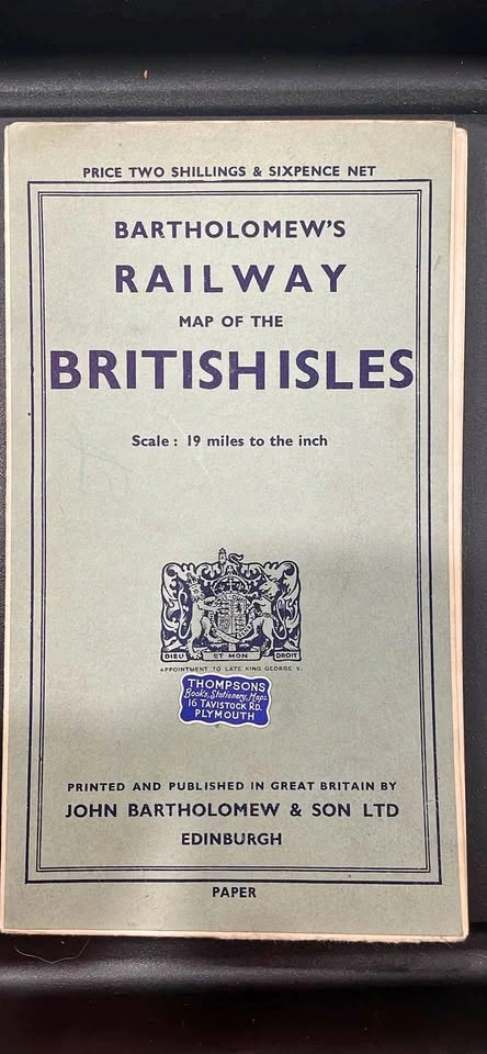
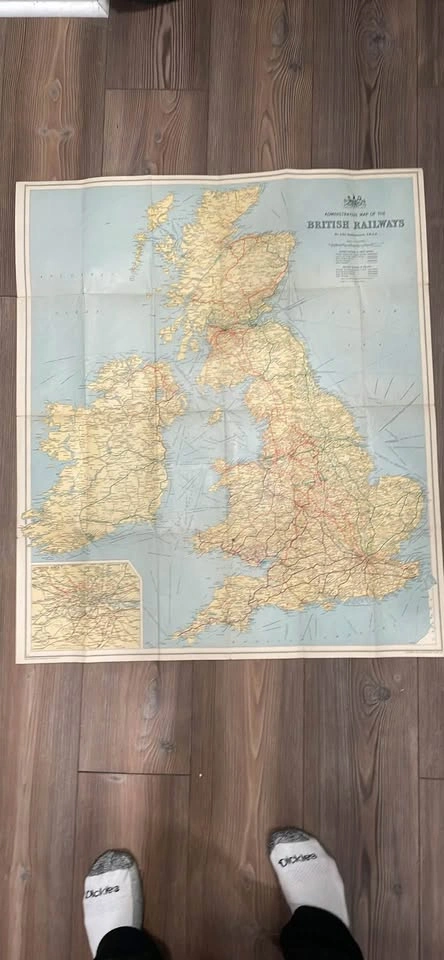
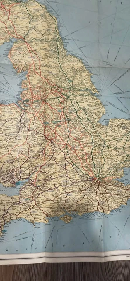
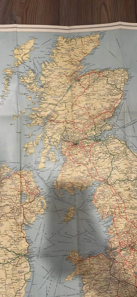
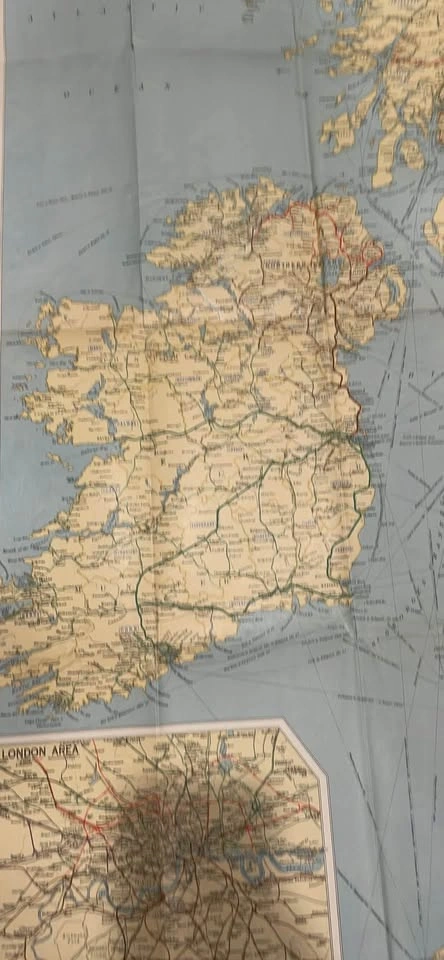
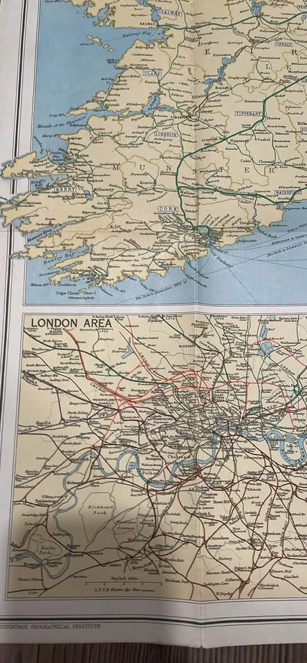
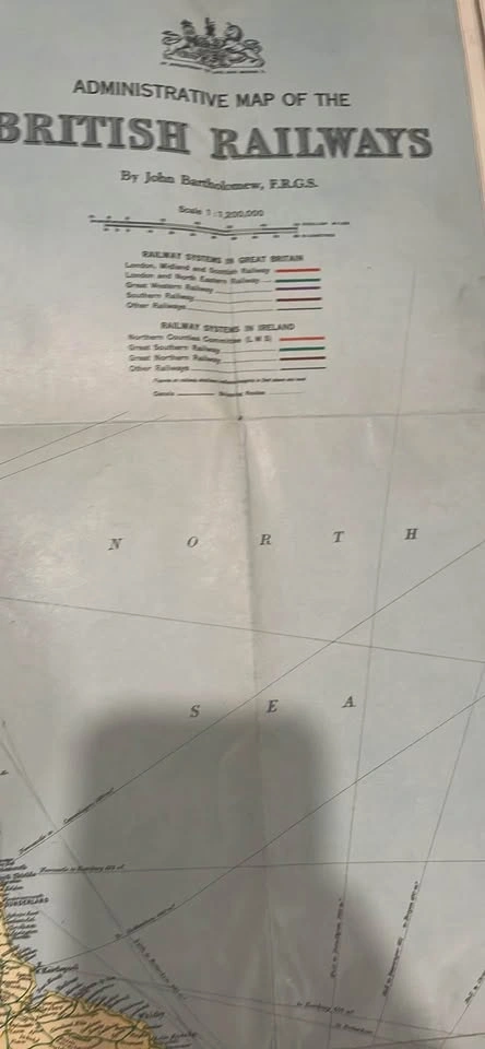
70I have a map from the 1940s or 50’s with the train system of the British islands. Very interesting to look at, please see the pictures we think it’s right around World War II but it could be shortly after that. Be perfect to use as a holiday gift and would look even better in a frame. I measured it multiple times and have came out to it being 29 inches tall, which makes no sense to me, but I measured multiple times, it’s just over 29 inches. Let me know if you have any questions and I will try to answer the best I can. I’m asking 100 but would take a reasonable offer this week. It can be picked up close to the corner of Wellington and seminary.
Other listings by Bradley
Show all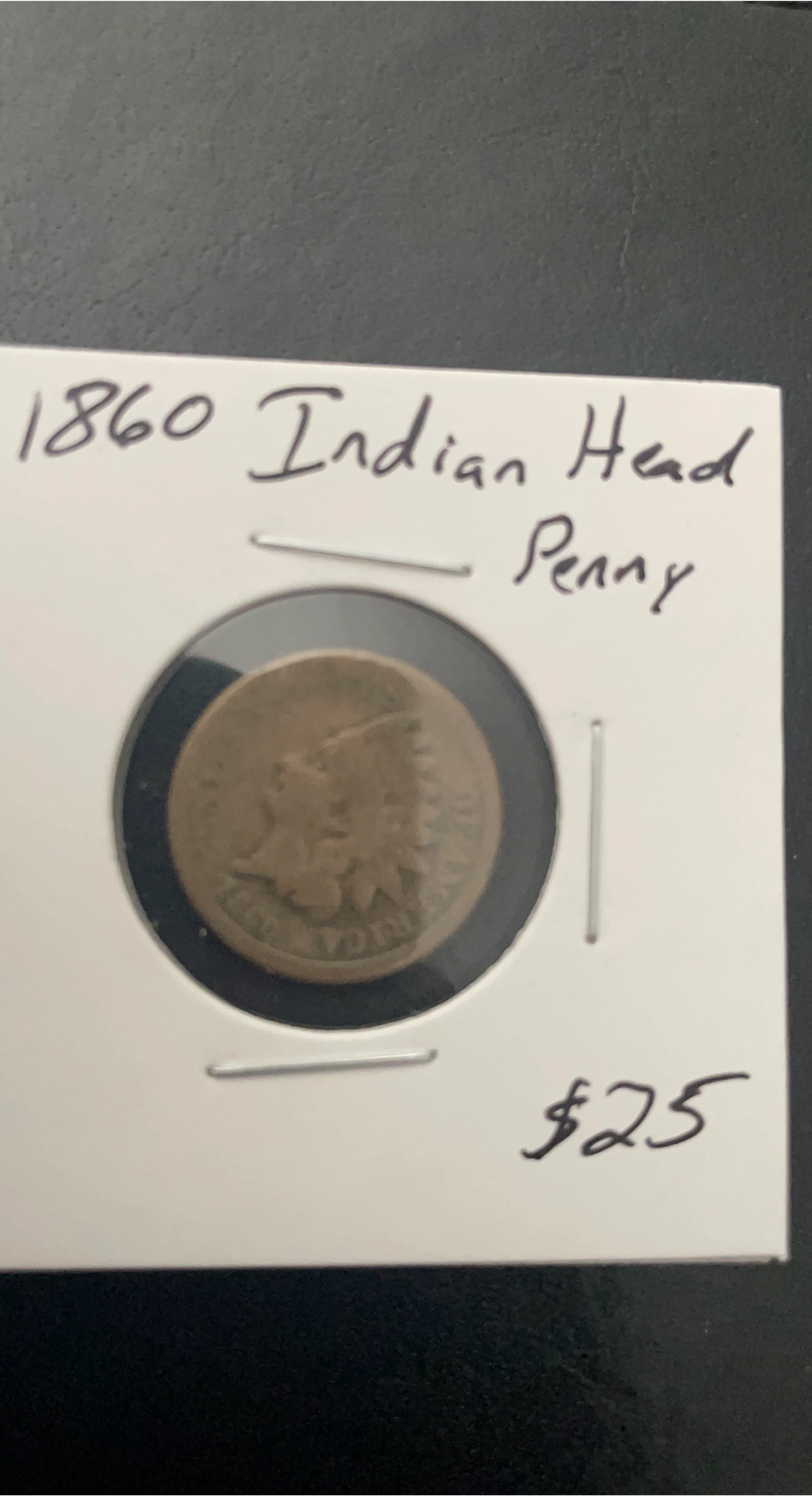
1860 Indian Head Penny - Collectible Coin
$25
Lake View
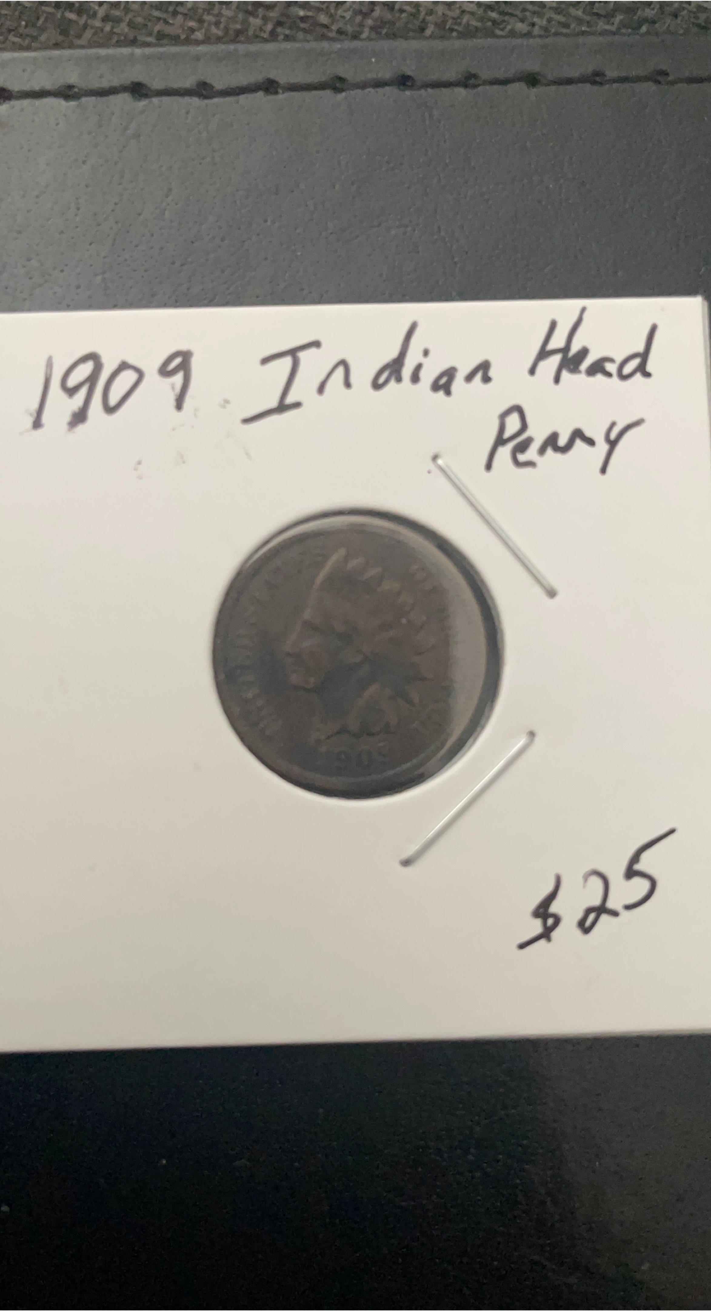
1909 Indian Head Penny
$25
Lake View

ITC Craft Instuction Manual: Giant Motorized Corvette
$7
Lake View

1967 World Map-Very Detailed-28”x24”
$60
Lake View

1960’s World Map - Population Density - 28”x24”
$60
Lake View

1593 Latin World Map (Reprint) - Good Condition
$250
Lake View
Popular on Karrot
Show all
1:24 ratio metal race car
$36
Elgin

Framed Print of Paris Street Scene
$65
Little Village

Vintage Red & White Teacup & Saucer, Johnson Bros.
$5
Beverly

Custom tattoos
$101
Logan Square

Norman Rockwell 'At the Vet' Print
$7
Belmont Cragin

Star Wars Comic Print Plush Bear
$4
Old Town

Handmade Wooden Rose Trinket Box
$134
Little Italy

Metal Wall Art Decor - Modern Design
$24
O'Hare

Vintage Porcelain Figurines
$19
Albany Park

NSFW MONSTER STANDEE (HAB)
$11
South Side

Vintage Silverware Collection
$60
Clearing

Antique Leaded Stained Glass Windows (Pair)
$500
Edgewater

Fine China set. 8 piece of each. for sale pickup Only.
$300
Jefferson Park

2010 Kennedy Half Dollar - JFK & The Peace Corps
$10
Lake View

Framed Chicago Map Art Print
$90
Lake View

Oil painting
$125
Elmwood Park

Beautiful artwork of the Great Hindu Avatars.
$88
North Center

Vintage Camel Cigarettes Lighter
$7
Chicago Ridge