Vintage Wall Map – Southwestern British Columbia (c. 1963)
$95
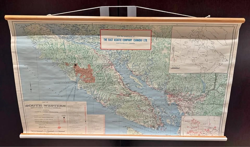
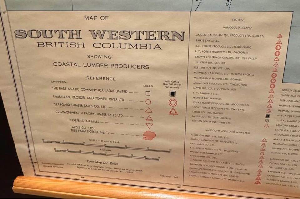
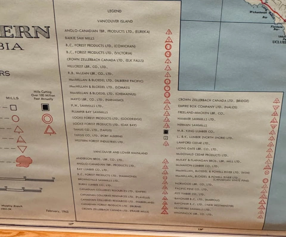
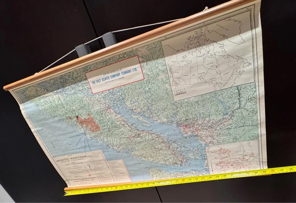
Original vintage wall map titled “Map of South Western British Columbia – Showing Coastal Lumber Producers”, produced in February 1963 and issued with the compliments of The East Asiatic Company (Canada) Ltd..
This large-format map details:
• Southwestern British Columbia & Vancouver Island
• Coastal lumber producers, mills, and forestry operations
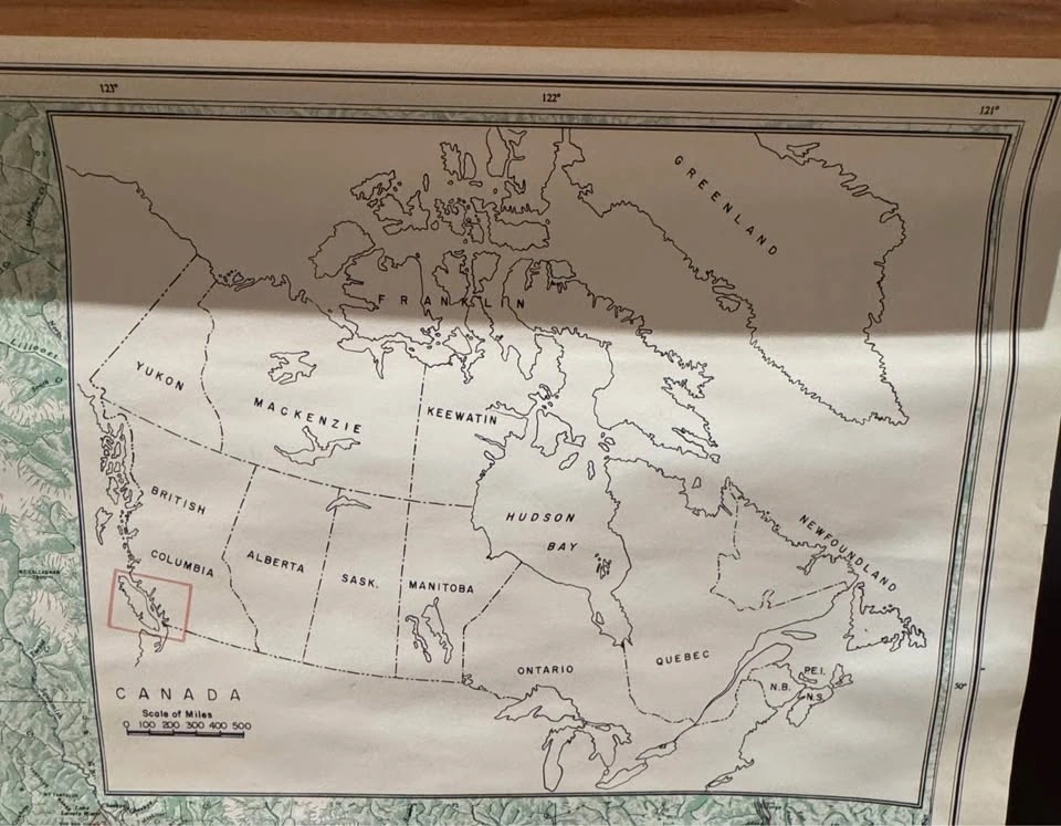
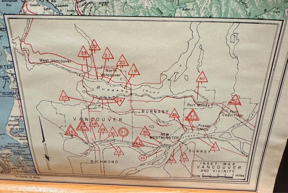
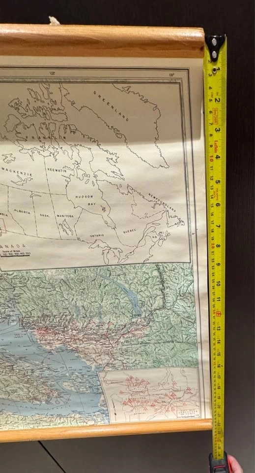
• Insets of Canada and Vancouver & vicinity
• Extensive historical industrial references (MacMillan Bloedel, Crown Zellerbach, Powell River, etc.)
Mounted with original wooden hanging rails (top & bottom) and cord, making it ready to display.
Approximate size:
~36” wide x ~24” tall (including rails)
Condition:
Good vintage condition overall for its age.
• Light age-related wear and gentle waviness consistent with a paper wall map from the 1960s
• Colors, text, and detail remain clear and legible
• No major tears or damage observed (see photos for full condition)
A fantastic piece for:
• BC history or forestry enthusiasts
• Map collectors
• Office, study, cabin, or industrial/heritage décor
• Anyone with a connection to the Lower Mainland or Vancouver Island
Open to reasonable offers.
Local pickup preferred.
Cash or e-Transfer accepted.
Happy to answer questions or provide additional photos.
Thank you for stopping by — feel free to check out my other listings, all the best!


0 chats0 favorites3 views